View/Edit Point Data
If the user needs to view or edit the raw data on any existing survey point which has already geophysical data attached to it, the View/Edit Point Data functions can be used. Simply select the point you would like to view or edit from the Project Data list.
Select the "View/Edit Point Data" option from the Project Data menu. The full menu can be seen by left swiping the Project data options bar. Right swiping will close the full option menu.


The Point Data menu will then appear and contains all the points data. Some data can be edited. If the user edits some of the points data, the "Accept" button must be pressed to save the changes.

To view or edit the geographical location of the selected point, select the "Position" tab under the "Info" Tab. The point position is shown in WGS84 Decimal degree format with GPS and SRTM altitude values in meters above sea level.

Modifiy Location
The user may modify the current point position by selecting the "Modify location" option.

The point location data can then be modified in the current point edit boxes provided. Should the user choose to determine the device location by reading the devices current GPS coordinate and applying this coordinate to the point location modification data. Then the user must select the "Determine current GPS location" option.

Determine current GPS location

Update SRTM
The SRTM elevation at the current modified location can also be collected using the "Update SRTM" option. To use this option, a LAT/Lon coordinate data must exist in the 'Current Latitude' and "Current Longitude" fields.


Apply location
To apply the new coordinate values to the point, select the "Apply location" option.
To view or edit the point parameters select the "Parameters" tab on the "Info" tab option. Here the user may change the points seismic velocity model and Soil resistivity value.

Restore original data set
If the user has modified any of the values in this menu, the original data, applied to the point after the last time the point data was processed, can be restored to the point by selecting the "Restore original data set" option.

The view the current stacked data set for the point, select the "Stack" tab.

To view the strike data sets that make up the current stack data set, select the "Strikes" tab.

To modify or view the all the strike data used or excluded from the current stack data set, select the "Data" tab. The user may add or remove strike data from the stack data by selecting the add or remove icon next to the strike data on the data list.

Strike currently added, click to remove from stack

Strike currently removed, click to add to stack

To view the Electric and magnetic field response data recorded for the point select the "EM RAW" tab

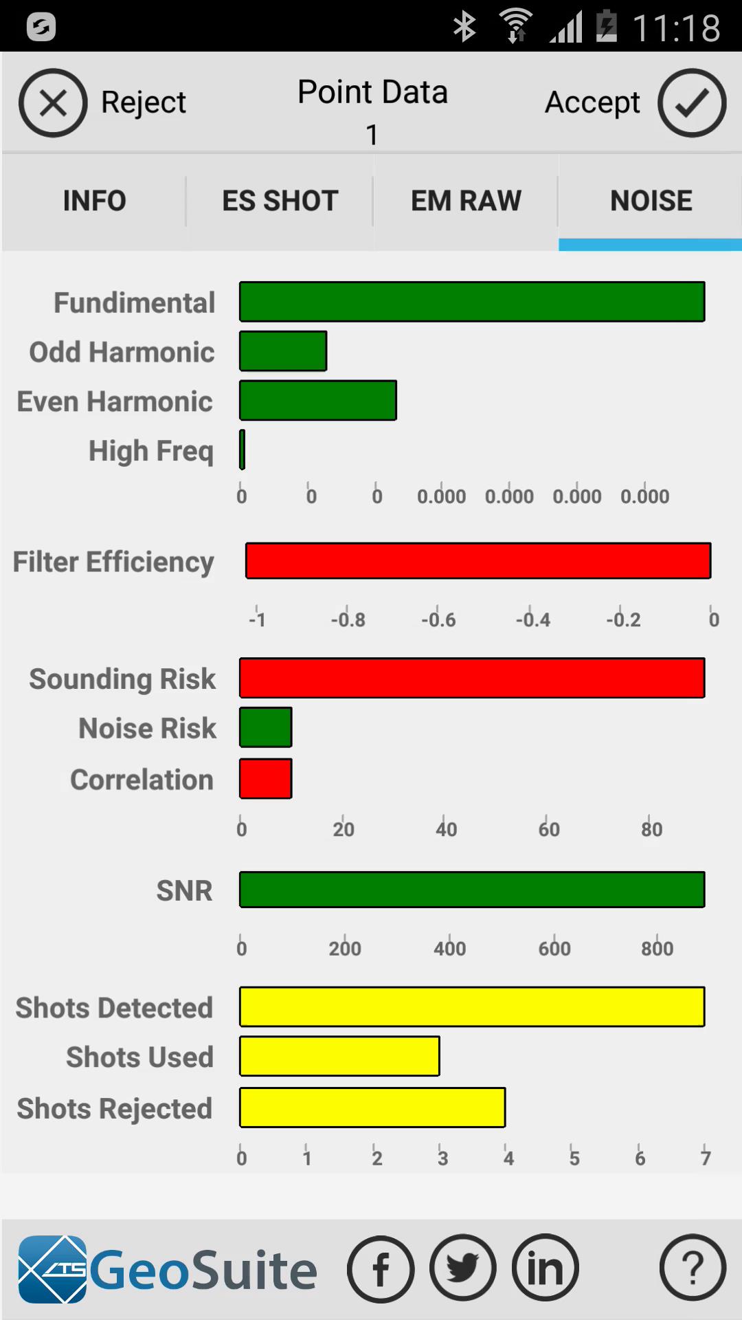
To view the calculated noise statistics for the point, select the "NOISE" tab.

Accept changes
To apply any and all changes made to the point data in any of the point data menus, the user must accept the changes first. This is done by selecting the "accept" option on the top right of the screen window.

Reject changes
To reject and discard any and all changes made to the point data in any of the point data menus, the user must reject the changes first. This is done by selecting the "reject" option on the top left of the screen window.